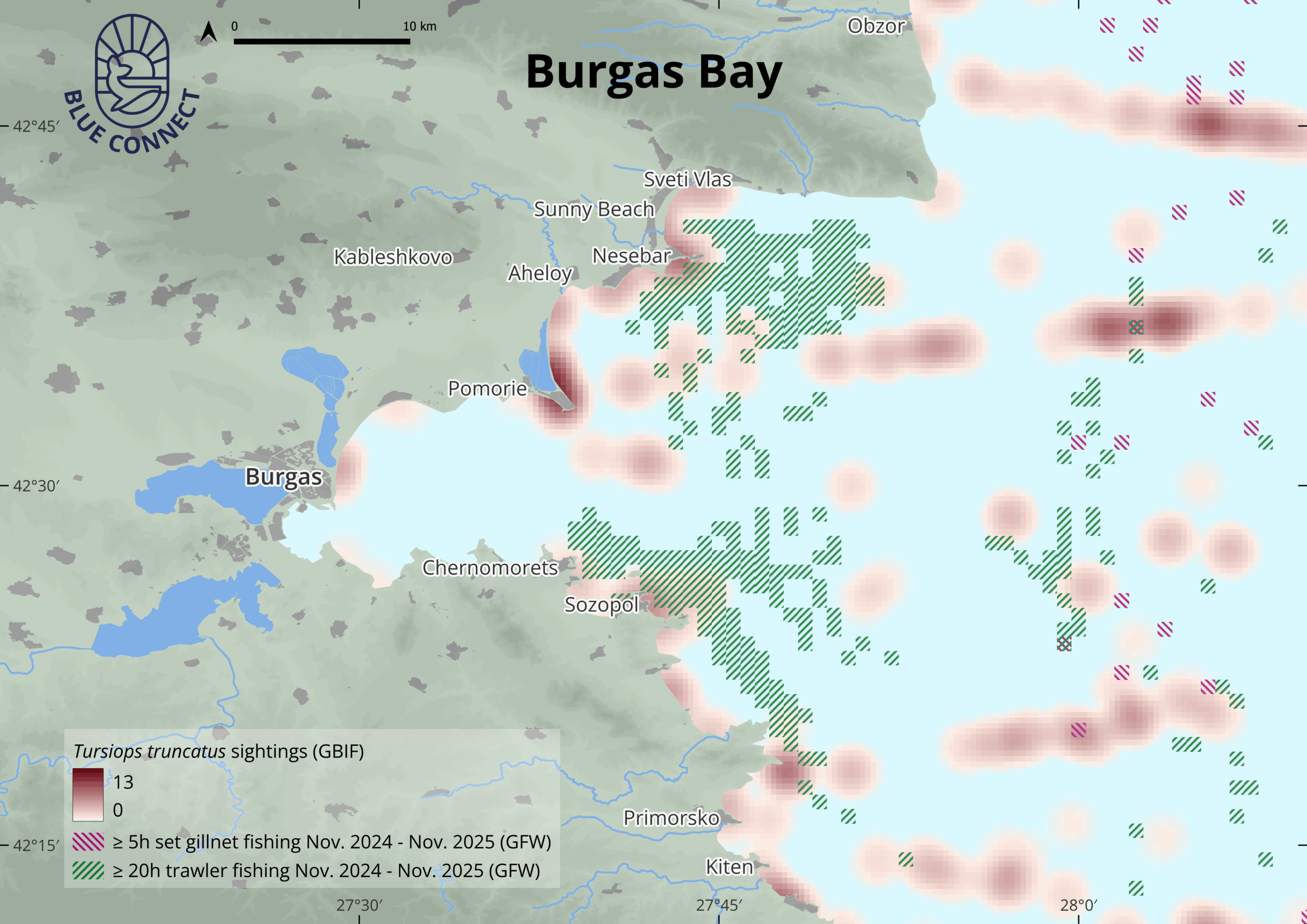
Created by our colleague Lawrence Whatley from VLIZ, the map visualises areas where trawling and set gillnet fishing – identified as key pressures – intersect with recorded sightings of bottlenose dolphins. The result is a powerful picture of where dolphins and fishing operations are most likely to interact, helping partners better understand potential hotspots of impact in Burgas Bay.
Within BLUE CONNECT, each of the 12 Demonstration Sites is working to identify priority ecological features and the human pressures that affect them. In Burgas Bay, marine mammals, and in particular the Black Sea bottlenose dolphin, have been highlighted as an important ecological subject.
At the same time, fishing – especially trawling and set gillnet fisheries – has been recognised by local partners as a significant pressure. Building on this, the Burgas Bay team is now working to understand where and how these pressures overlap with dolphin presence.
The work in Burgas Bay is led by Deltares, in close collaboration with the Bulgarian Biodiversity Foundation and the Centre for Coastal and Marine Studies (CCMS). Together, they are combining ecological knowledge and spatial data to support better-informed decisions on conservation and restoration.
The 30 Day Map Challenge is an annual, community-led event held every November, where participants around the world create and share a different map each day, following a set of daily themes and posting them under the hashtag #30DayMapChallenge.